Inspection and Facilities Documentation — Why Commercial Properties Are Switching to Drone-Based Documentation
Commercial facility documentation has traditionally meant a combination of ground-level photography, periodic roof walks, and scheduled inspections that are slow to schedule, expensive to execute, and often incomplete because accessing every surface of a building safely is harder than it sounds. Drone-based documentation changes the fundamental economics of this process — compressing a multi-day documentation effort into a single session, capturing surfaces that are inaccessible on foot, and delivering a record that is more complete and more defensible than anything traditional methods produce.
The Three-Drone Approach: Purpose-Built Tools for Each Deliverable
Our facility documentation service does not use a single drone for every task, because no single drone is optimally suited for every task. We deploy three aircraft — each selected for a specific part of the documentation process — and coordinate them to deliver a complete facility record in one visit.
The DJI Air 3S handles the four professional marketing shots included with every session. With its one-inch CMOS sensor and cinema-quality color rendering, it produces imagery that works directly for real estate listings, facility brochures, insurance documentation, and marketing materials — delivered with full color correction and retouching.
The DJI Matrice 4E handles our precision inspection passes and RTK data collection. Its enterprise-grade stability allows us to hover at controlled altitudes and zoom in on specific structural areas — façade conditions, roofline details, HVAC equipment, drainage features — without anyone setting foot on the roof or requiring scaffolding. Its RTK positioning makes the mapping data it captures repeatable and survey-grade.
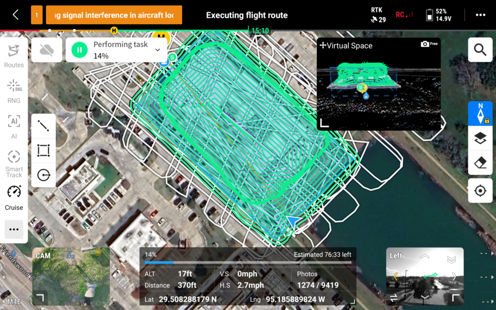
For complex multi-structure facilities, the DJI Manifold 3 enables fully autonomous inspection paths. The Manifold 3’s onboard AI computing power allows the aircraft to systematically cover every elevation and roofline, ensuring complete coverage and producing a flight record that can be re-executed identically at the next inspection interval.
The Online 3D Model: What It Replaces in Your Operations
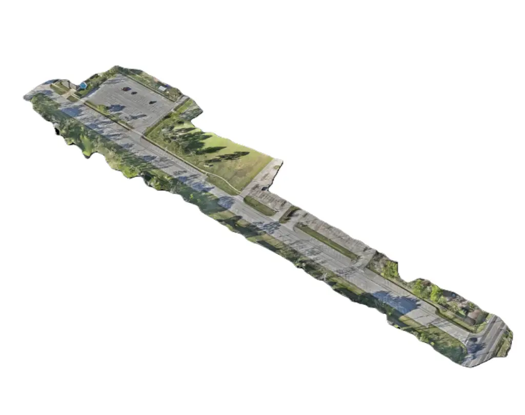
The centerpiece deliverable for most facility documentation sessions is the shareable online 3D model — a photorealistic, centimeter-accurate three-dimensional reconstruction of the facility produced from overlapping high-resolution imagery captured during the inspection flight. Once processed and hosted, this model is accessible to anyone you share the link with, from any device, without software installation.
Consider what this replaces in practice. An architect reviewing a façade for renovation scope no longer needs a site visit to understand the building. An insurance adjuster reviewing a claim can examine the structure from any angle and measure dimensions directly in the model. A roofing contractor preparing a bid can see the full roofline, identify complex areas, and estimate material quantities before ever visiting the site. A property manager sharing a facility with a prospective tenant can provide an immersive walk-through that communicates scale, condition, and layout more effectively than any photograph.
All of this happens without anyone stepping foot on the property, without scheduling multiple vendor visits, and without the liability exposure that comes from having uninvited trades on a roof or in a mechanical area during the documentation process.
The Insurance Case: Why Time-Stamped Aerial Documentation Matters
Insurance disputes about facility damage often come down to one question: was this damage pre-existing, or did it happen in the event being claimed? Ground-level photography is easy to dispute — angles are inconsistent, coverage is incomplete, and the absence of a photo of a specific area is not proof that the area was undamaged. Time-stamped, geolocated aerial imagery captured by a registered commercial drone operator under FAA Part 107 certification is significantly harder to dispute.
A pre-event facility documentation session establishes a clear baseline for every accessible surface of the building. When a storm, hail event, or other incident occurs, a post-event session produces a directly comparable record that can be overlaid against the baseline. Damage that is new is visible. Areas that were already compromised are documented as pre-existing. The insurance conversation shifts from a credibility contest to a documentation review.
Maintenance Planning and Early Intervention
The most expensive building repairs are almost always the ones that were allowed to develop undetected. A lifted shingle costs very little to replace. The water damage it allows — rot, mold, structural compromise — costs orders of magnitude more. Identifying compromised flashing around HVAC penetrations costs nothing to note on a drone inspection. Repairing the moisture intrusion after it has been ignored for two seasons costs significantly more.
Annual or semi-annual drone documentation sessions give facility managers a systematic early warning system for every surface of their buildings. Issues are identified in the inspection record before they become visible from the interior. Maintenance is scheduled proactively rather than reactively. The cost of the documentation session is trivial compared to the cost of the repairs it prevents.
DroneWorks of Friendswood serves commercial and residential facilities throughout the Gulf Coast area. Call for pricing, scheduling, and availability on multi-structure or out-of-area facilities.