who we are

-- Legally authorized for commercial airspace operations
-- Insurance and liability coverage properly in place
-- Reduces your risk using unlicensed operators
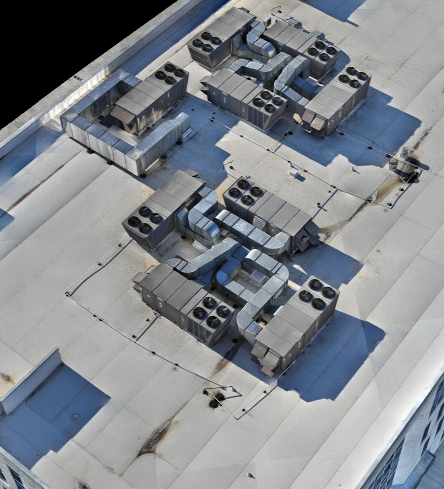
-- 2D / 3D Mapping can be done over people and moving vehicles.
-- Photography and videos over public events
-- Security

-- Interactive models, no downloads needed
-- Secure client-ready sharing links
-- Supports 3D, thermal, and orthomosaic data
who we are
The DJI Matrice 4E wide-angle camera is specifically engineered for efficient and high-precision mapping and surveying. It features a large 4/3-inch CMOS sensor with 20MP effective pixels and a 24mm equivalent focal length. A key feature for mapping is its mechanical shutter, which eliminates rolling distortion (motion blur) in images captured at high speeds, crucial for generating accurate 2D orthophotos and 3D models.
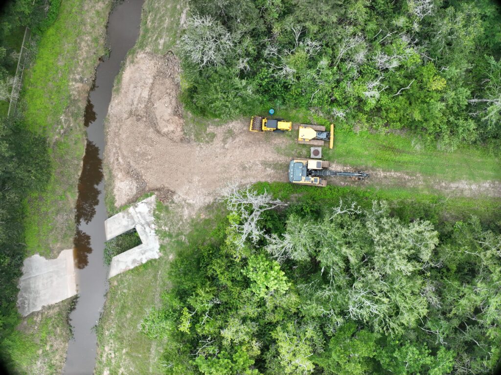
On construction sites, AI can display and count the number of vehicles and staff in the facility. This is useful for determining safety before an extensive mapping flight so that we are sure we will not put anyone in danger. This can also be used for security concerns.
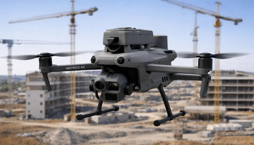
The DJI Matrice 4E comes with a built-in RTK (Real-Time Kinematic) module that provides centimeter-level positioning accuracy, a significant upgrade over standard GPS systems. This integrated system eliminates the need for an external, attachable module and supports the extended L5 frequency band, enhancing reliability even in complex environments with potential signal interference, such as near metal structures or high-voltage lines.
The DJI Matrice 4E drone offers 16x digital zoom and up to 112x hybrid zoom. This zoom capability allows for detailed observation of structures or areas from a distance, keeping out of dangerous areas, when necessary, all while getting the information you need.
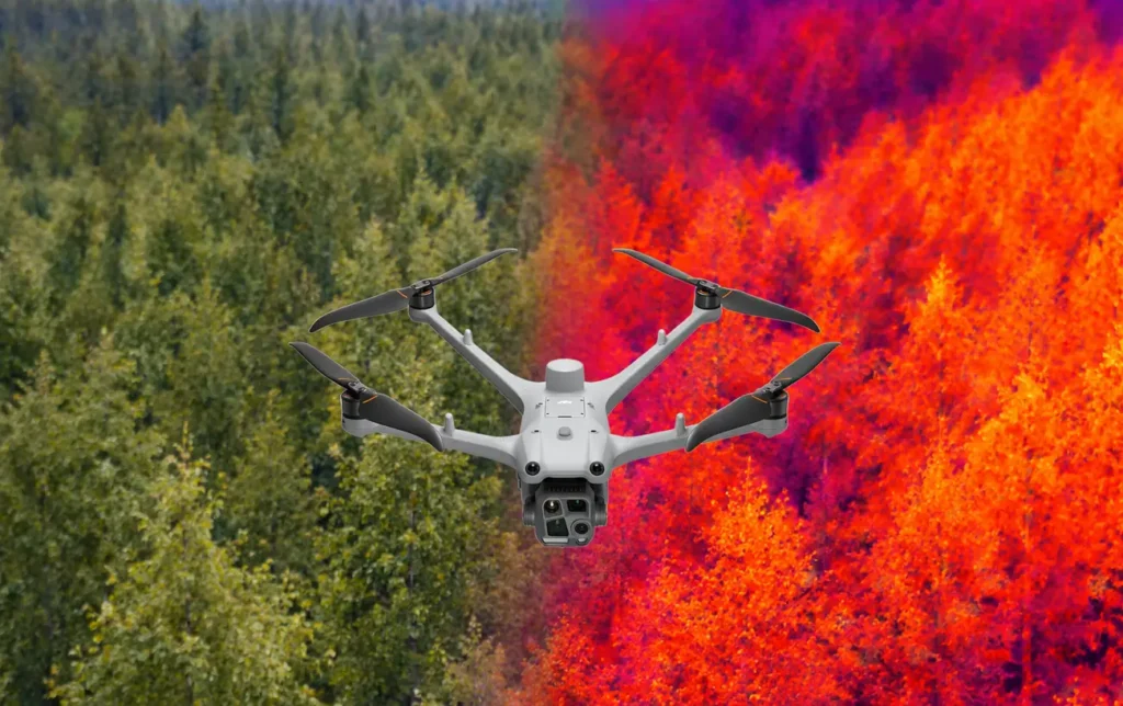
Contains a thermal imager with 640×512 resolution that can upscale to 1280×1024 (Ultra-High Resolution mode) for fine heat detection. It is paired with an NIR auxiliary light for 100-meter visibility in total darkness.
The DJI Matrice 4TD features a professional-grade IP55 rating, certifying its resilience against dust ingress and low-pressure water jets from any direction. This weatherproofing allows the aircraft to operate reliably in harsh conditions, including light rain, snow, and high-dust environments, which is critical for time-sensitive public safety and industrial missions. Complementing this rating, the M4TD is engineered for extreme climates with an operating temperature range of -20°C to 50°C (-4°F to 122°F) and features anti-icing propellers to maintain stable flight in freezing rain.
This serves as a specialized electrical inspection tool, using its 48MP telephoto camera and 1280x1024 high-resolution thermal mode to identify physical defects and thermal hotspots from safe distances. Its integrated 80° upward-tilting gimbal enables clear views of overhead substation structures, while an optional sensing module detects wires as thin as 12 mm to prevent collisions.
The 4TD provides first responders with rapid situational awareness through integrated AI detection for people and vehicles and an NIR auxiliary light for 100-meter visibility in total darkness. Its high-resolution thermal imaging penetrates smoke and foliage to locate heat signatures, while the AS1 speaker and signal relay capabilities facilitate communication and stable links in complex terrain. Designed for urgency, the aircraft deploys in under 15 seconds and uses real-time mapping via DJI Pilot 2 to ensure thorough search coverage during critical missions.
The primary camera is equipped with an upgraded 1-inch CMOS sensor and a 24mm equivalent lens, capturing highly detailed 50MP still images and enhancing low-light performance. The secondary camera is a 3x medium telephoto lens with a 70mm equivalent focal length and a 48MP 1/1.3-inch CMOS sensor, ideal for capturing expressive portrait shots with a strong sense of spatial compression.
Both cameras are capable of recording cinematic 4K/60fps HDR video, 4K/120fps slow-motion footage, and support 10-bit D-Log M and HLG color modes for extensive post-production flexibility.
Allows us to film clients doing property walkthroughs keeping them centered all while avoiding obstructions.
This allows us to design the drone route, angle and zoom when producing a video that shows off many aspects of the property in a concise and planned route that can be adjusted and repeated.
Built for durability, the unit features an IP55 rating and operates in extreme temperatures from -20°C to 50°C, ensuring reliable performance in harsh industrial environments.
The DJI Manifold 3 significantly enhances LiDAR operations by serving as a high-speed onboard processor for raw point cloud data. With its 100 TOPS of AI power, it enables real-time sensor fusion, allowing the drone to overlay thermal or visual anomalies onto 3D point clouds instantly during flight. This integration supports advanced features like Smart 3D Explore, where the aircraft can autonomously map a site and plan optimized inspection routes without human intervention.
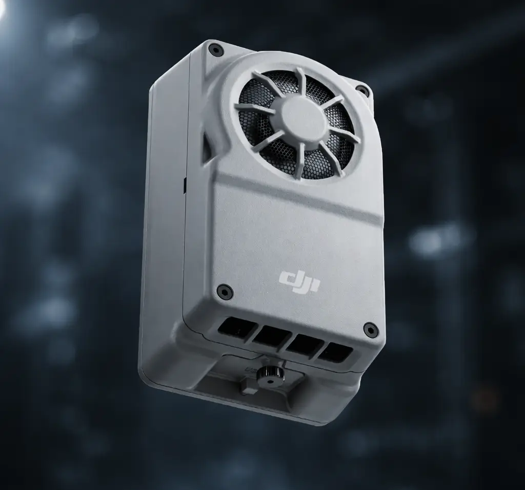
The DJI Manifold 3 offers extensive expandability via an onboard USB-C 3.2 Gen 1 port that supports Power Delivery (PD), allowing for the direct connection of external hardware such as 4G cellular modems, SSDs, and specialized third-party sensors.
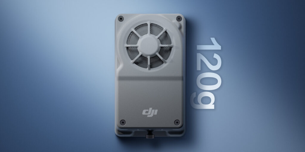
This serves as a high-performance onboard computing unit designed for the Matrice 4E and 4TD. Powered by the NVIDIA Jetson Orin NX chipset, it delivers up to 100 TOPS of AI computing power, enabling drones to process complex data and run deep-learning models directly at the edge. This capability allows for real-time object detection, classification, and autonomous decision-making for missions like power line inspections, search and rescue, and environmental monitoring.
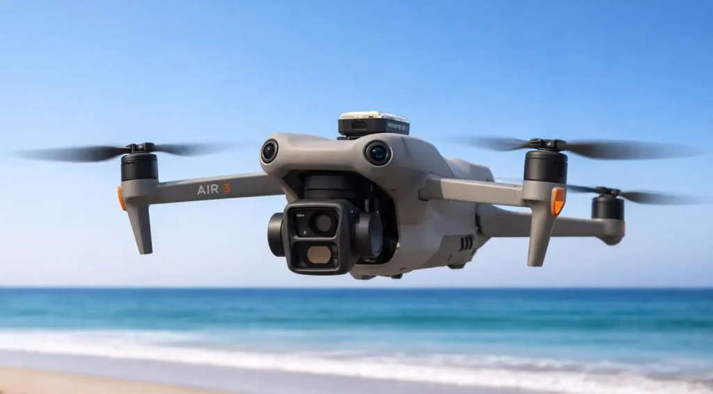
With a pilot that is FAA Part 107 certified and a Remote ID module, the Neo (135 grams) can be flown over people carefully. Category 1 is achieved because of the propeller guards, and the attached Remote ID (13.5 grams), the certification and that the entire drone is still under the 0.55 lbs. FAA requirement.
When using an iPhone with the DJI Fly app, DJI Neo can record audio with DJI Mic 2, [11] which can connect to your mobile phone via Bluetooth or directly through the phone's built-in microphone. The DJI Fly app can also automatically eliminate propeller noise and merge your audio track with your footage to ensure clear sound even when shooting low-altitude vlogs. Neo can also be used with a professional controller to set waypoints for smooth, controlled flights.
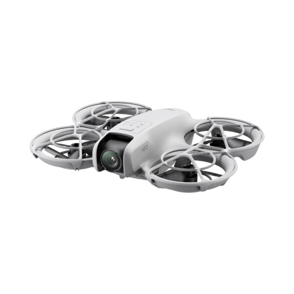
While in Palm Control, pressing the mode button on the top switches among multiple intelligent shooting modes, including Follow, Dronie, Circle, Rocket, Spotlight, and Custom.
DJI Neo sports a 1/2-inch image sensor for snapping 12MP stills. It can produce 4K UHD stabilized videos straight out of the camera, and 1080p vertical video. It also supports multiple resolutions and frame rates for video recording and up to 4K/30fps RockSteady/HorizonBalancing videos that maintain clarity in highlight and shadow areas, ensuring that rich detail is visible.
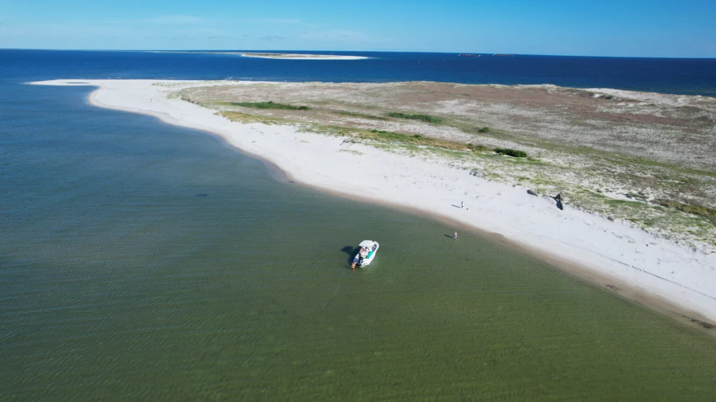
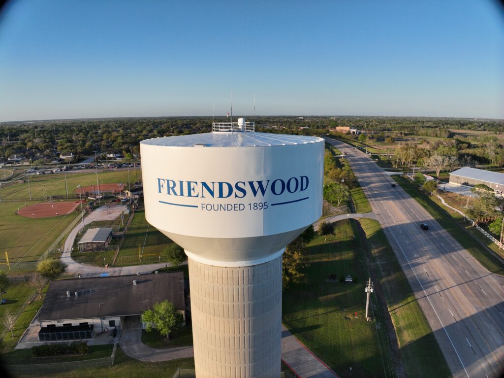
latest projects
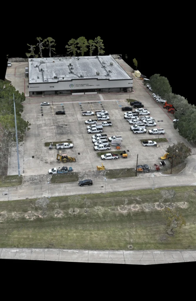
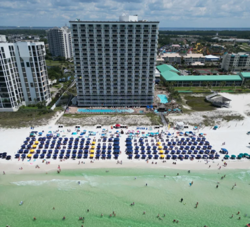
Our Gallery of some of our best Aerial Photography
Packages and Capabilities
why choose us

Drone Works delivers unmatched aerial photography and videography with precision and skill

We turn your ideas into breathtaking aerial shots, offering innovative solutions for all

Our team of certified drone pilots ensures safe, reliable, and stunning results for every project

Drone Works uses cutting-edge drones and equipment to provide exceptional and detailed visuals
our teams